WHERE WILL YOU BE ON AUG. 21, 2017? The Great American Solar Eclipse
is less than two months away. Do you know where you will be? The map
below shows the path of totality (the narrow zone where the Moon
completely covers the sun) overlaid on a statistical map of cloudiness
for the month of August. The best places to be are blue:
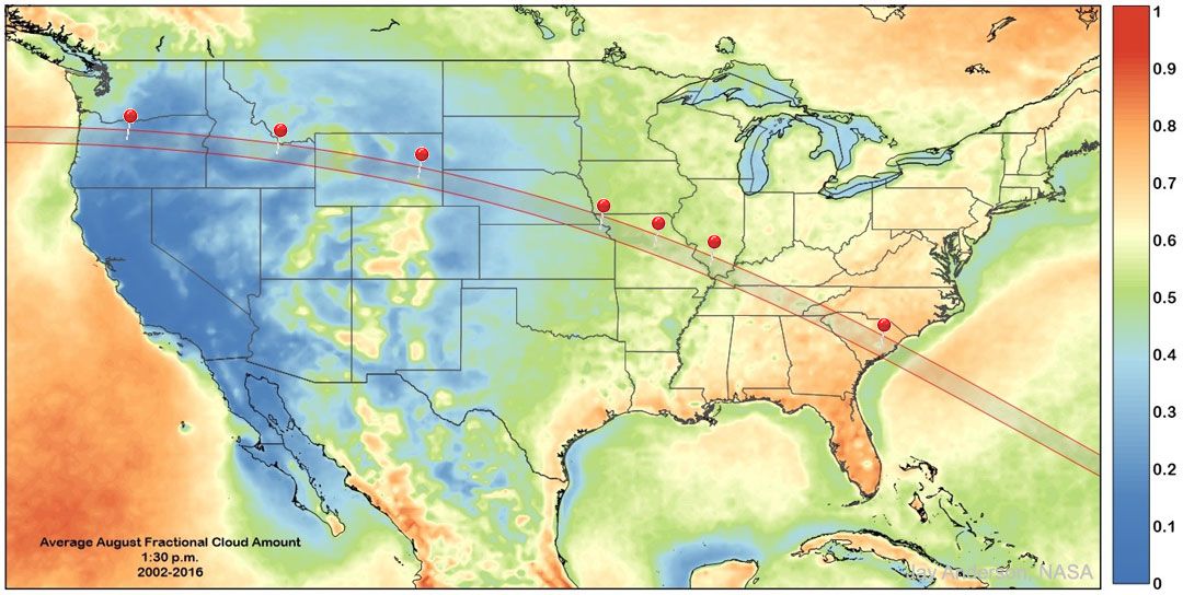
Pushpins in the map show confirmed launch sites for the our Solar Eclipse Balloon Network. Using space weather balloons, teams of student researchers will launch cameras to the stratosphere for a unique view of the eclipse high above any obscuring clouds. There's more to their mission, however, than photography: Each balloon will also be equipped with an array of cosmic ray sensors. By the time the eclipse is finished, we will have gained a snapshot of how deep-space radiation is penetrating Earth's atmosphere across the entirety of North America. Want to join us? Click here.


Commenti
Posta un commento